Itinerario: Norvegia, Hornelen (la scogliera a picco sul mare, più alta del Nord Europa) – da HUNSKÅR, Bremanger a LISETE, Berleneset
Distanza: 14 km circa (dal porticciolo di arrivo a HUNSKÅR, Bremanger all’attracco del traghetto a LISETE, Berleneset)
Dislivello salita: 1000 m circa
Dislivello discesa: 910 m circa
Tempo: cammino effettivo 6 ore (considerare almeno 8-9 ore di tempo, in pratica l’escursione occupa l’intera giornta). Per raggiungere la vetta aggiungere almeno altri 90’ circa (la salita non è riportata nella traccia, segnaletica in posto).
Difficoltà: IMPEGNATIVO (così indicato anche nelle guide norvegesi – difficoltà 4 scarponi); è necessaria un’ottima esperienza di escursionismo e di ambiente montano. Attenzione: in caso di tempo incerto o maltempo, non intraprendere il cammino! Il periodo migliore, a nostro avviso, è quello estivo. Fondamentali: zaino, giacca in goretex, scarpe da montagna (già collaudate!), cappello in testa, occhiali da sole (consigliati!) crema solare, cibo energetico e tanta acqua da bere!
Rilevatore: Tiziana Ravagli, Giampaolo Filippucci
Autore della scheda: Tiziana Ravagli, Giampaolo Filippucci
Il tracciato da noi percorso è indicato con il segnavia ‘T‘ e con ‘omini di pietra’, ma non sempre è facilissimo da seguire (si consiglia una guida locale)
La traccia riportata è puramente indicativa e di semplice riferimento, rilevata con una APP per Android (myTracks) il giorno 11 luglio 2014 – giornata calda, soleggiata, meravigliosa con brezza leggera
Dal diario di viaggio del gruppo CAI – Foligno. 11 luglio 2014
Partecipanti: Enrico (capo-gruppo), Per Otto (capo-gruppo), Fausto, Gualtiero, Giampaolo, Marisa, Anna Rita, Clara, Tiziana, Stefano
Se qualche norvegese vi invita a fare una passeggiata, non fermatevi al termine passeggiata, chiedete tutte le dovute informazioni: lunghezza, dislivello reale e soprattutto una bella e dettagliata descrizione dell’intero percorso e specialmente quanti massi, quanti sassi, quanti gradini rocciosi, quanti saliscendi pietrosi incontrerete lungo il vostro “cammino”.
E ancora… non sarete salvi!
Il termine “passeggiata” in italiano risponde a un codice semantico ben definito, in norvegese decisamente a un altro: e qui nasce l’equivoco!!!
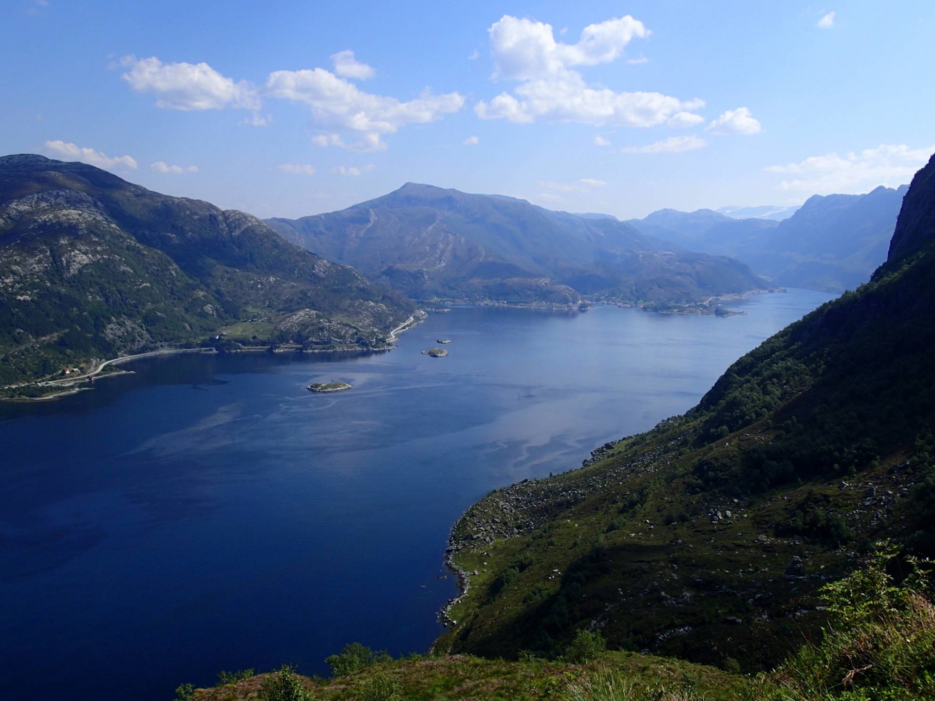
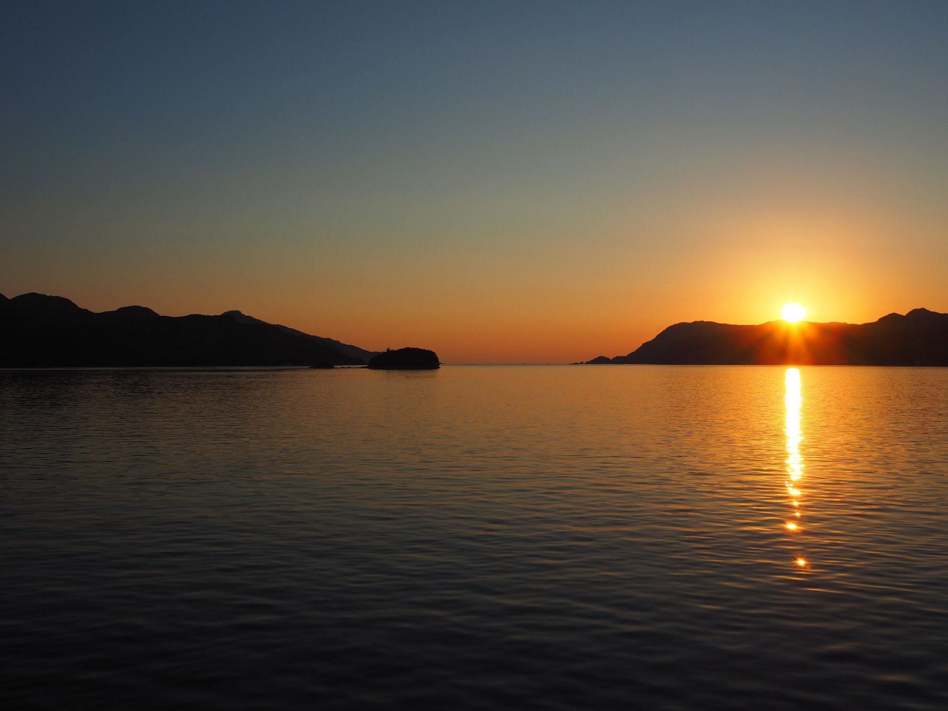
In effetti: scesi dal battello rimaniamo affascinati dal paesaggio, dal verde, dalla bellezza del mare che si insinua nella terra con i suoi riflessi e i suoi silenzi, con i suoi moti leggeri tra il cobalto e l’ottanio, dai fiordi che incantano.
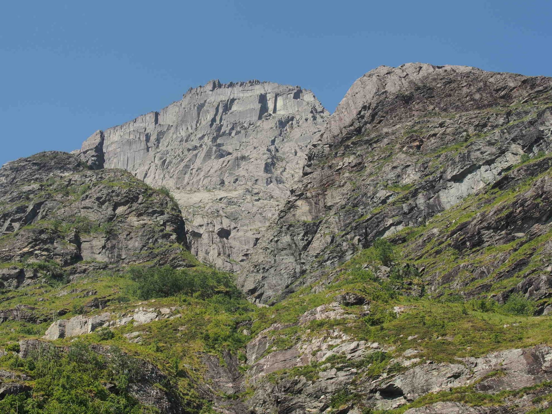
Poi, se solo fossimo stati meno presi da questa malia, dall’ebrezza di questa terra straniera che non sentiamo affatto come tale, se fossimo stati in Italia, ad esempio, avremmo certamente alzato gli occhi con più attenzione verso la montagna che ci sovrasta, che si innalza repentina e imponente, che si erge, o se vogliamo si cala, a picco sul mare.
Avremmo notato le tracce di sentiero, il filo sottile, a tratti impalpabile, che lega i blocchi scistosi e segna con leggerezza il massiccio che incombe: una roccia che, almeno oggi che è asciutta, regge magnificamente le suole delle nostre scarpe, rendendo più sicuro ogni cammino.
Non fatevi ingannare dalle giovani vichinghe che, con semplici scarpette da trekking leggere e una borraccia in vita, vi sorridono, salutano e partono, agilmente ascendendo come se ci trovassimo veramente di fronte a una semplice, meravigliosa passeggiata.
E qui torniamo al punto di partenza… su una cosa italiano e norvegese concordano serenamente: sul termine meravigliosa, per il resto è un ambivalente enigma linguistico che ciascuno potrà sciogliere e declinare secondo le proprie forze, le residue energie che riesce a scovare negli anfratti ancora non totalmente ossidati dall’acido lattico, nelle ginocchia e nei quadricipiti femorali (retto femorale, in testa) che vogliono resistere… nonostante tutto, nonostante… l’Hornelen!
Le ginocchia e i quadricipiti femorali, appunto: questi sono altri elementi su cui investire, in prospettiva.
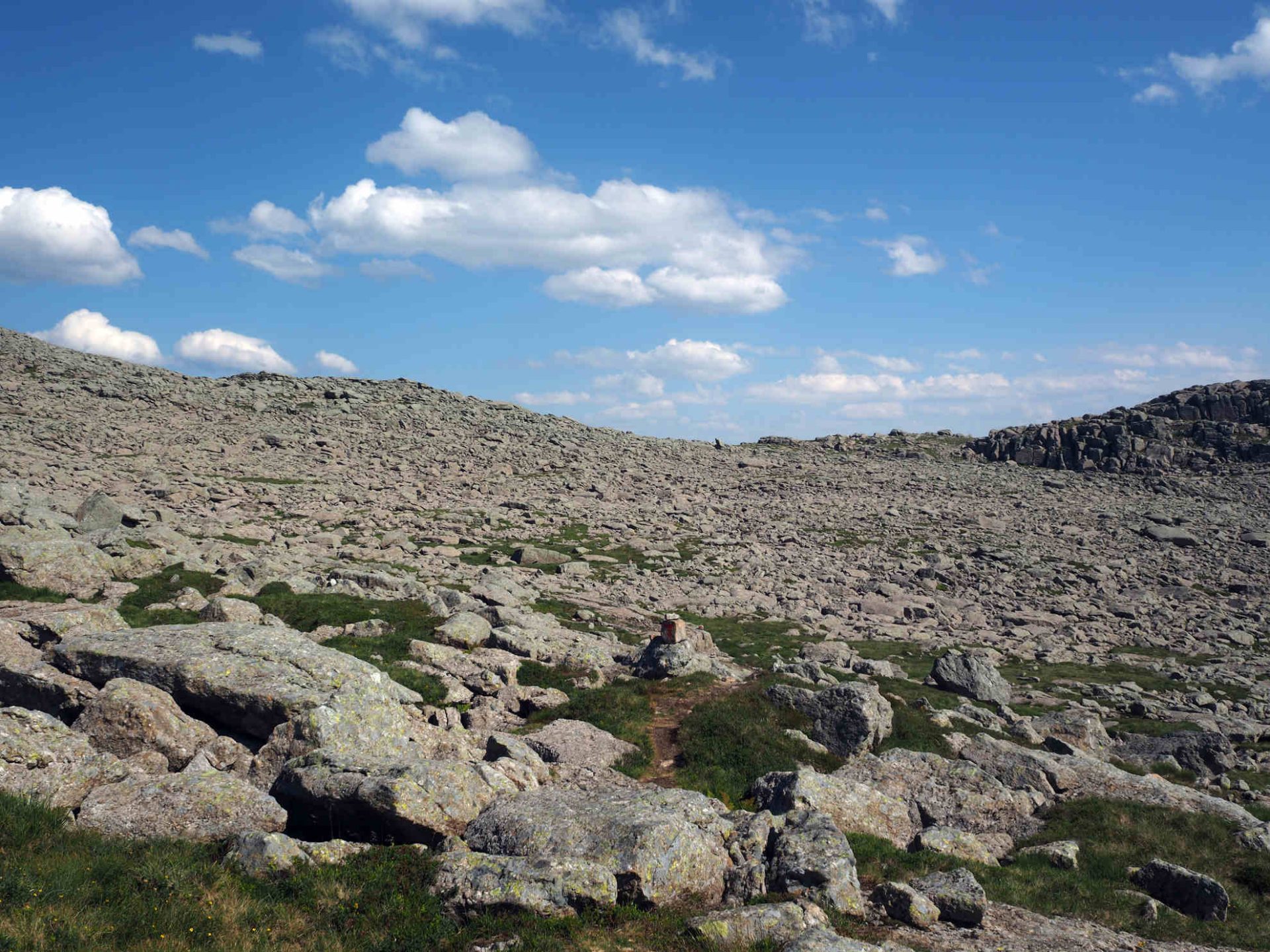
L’Hornelen, infatti, non è una semplice ascesa e un’ancora più duttile discesa, l’Hornelen, infatti, è una immensa gradinata che sale e poi scende, che poi risale e poi ridiscende, inframmezzata da altri gradini rocciosi sempre diversi, per dimensioni, altezze, spessori, larghezze… per tutto quello che può rendere improponibile allentare la tensione e dedicarsi all’amena (e bucolica) contemplazione dei luoghi; e questo è il punto definitivo, i luoghi: meravigliosi!
E come già detto: su questo termine, invece, noi e i norvegesi ci intendiamo splendidamente.
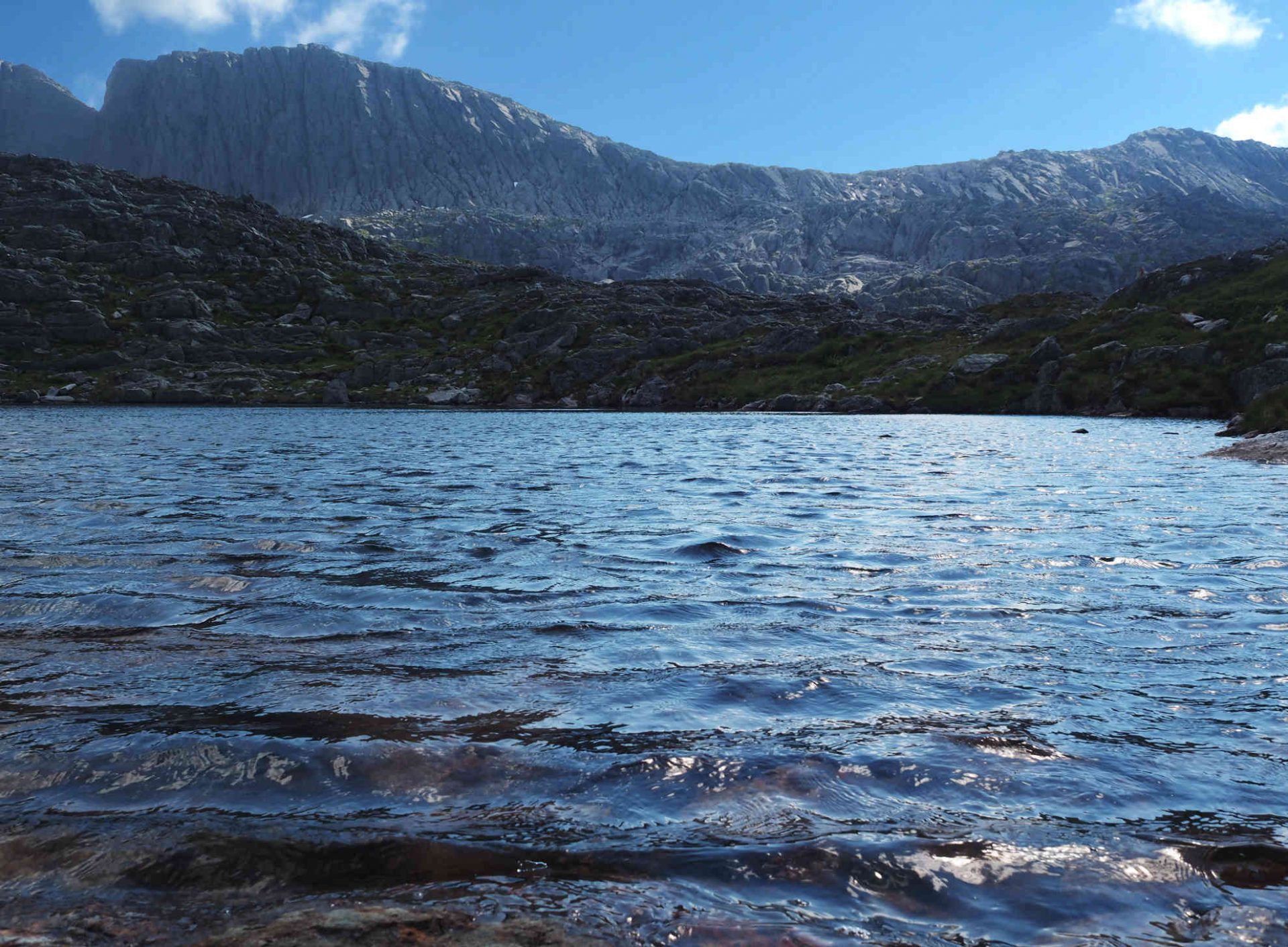
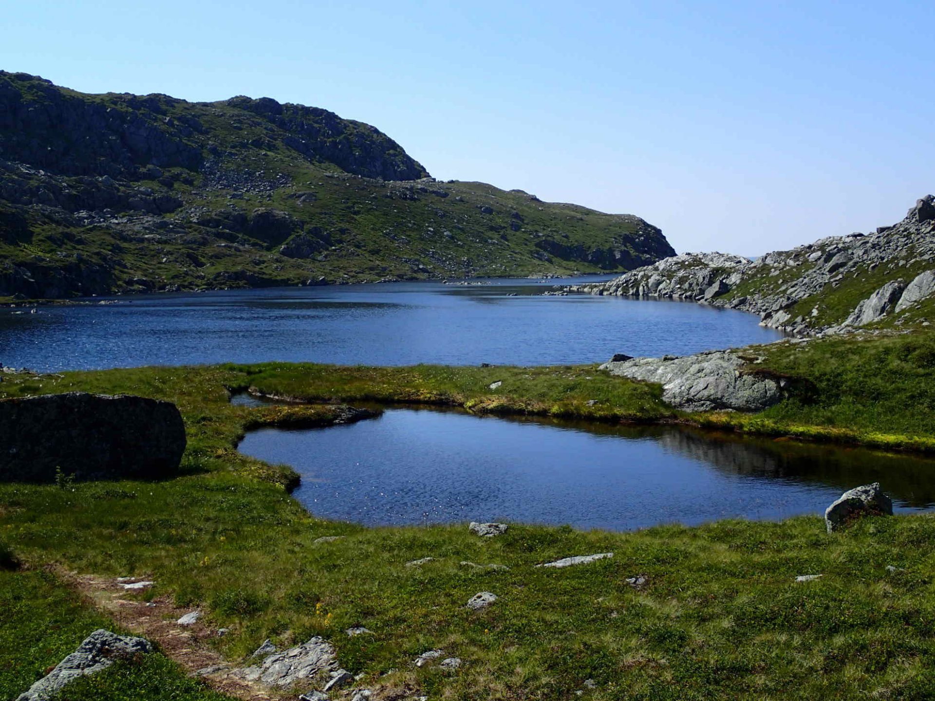
Il verde, i laghetti sommitali da cui attingere (ma solo in alcuni punti e solo in alcuni laghetti, per nostra fortuna eravamo in compagnia di un amico norvegese profondo conoscitore dell’ambiente montano!) l’acqua fresca e delicata che ci permette di dissetarci e proseguire! Di continuare la nostra gradinata prima verso il cielo, poi verso il mare, di superare roccette con mani e piedi, di passare oltre tratti un poco esposti (fortunatamente pochi), di lasciarci scaldare e abbronzare dal sole cocente, impensabile forse, ma oggi realtà dei nostri passi, di rinfrescarci con la brezza leggera che a tratti ci fa respirare a pieni polmoni (finalmente!).
Di superare un colle e poi un altro, di passare da un versante all’altro, tra rocce grigiastre, in una discesa che sa a tratti di salita e sembra non finire mai!
Di attraversare spezzoni impervi di costa rocciosa con eriche, callune e ginepri bruciati dal gelo salmastro che l’anno passato, o forse il precedente, ha imperversato con il vento, strinando senza pietà una natura che oggi prepotentemente rinasce.
Di godere, infine, fino in fondo questa estate norvegese con le sue giornate che non finiscono mai, come il nostro cammino.
E domani: niente Hornelen, per favore!
P.S.: è stata una delle più belle escursioni mai compiute!
Per saperne di più:
www.visitnorway.it
Un grazie speciale a Per Otto per TUTTO!
Download itinerario
L’itinerario può essere scaricato per utilizzarlo con i dispositivi GPS, le applicazioni GPS dei dispositivi Android, iOS, ecc., e per elaborarlo con i più diffusi software GIS.
Prima di intraprendere ogni nuovo cammino, ti invitiamo a leggere le ‘AVVERTENZE PER L’USO DEI PERCORSI PROPOSTI’.
Il modello di rappresentazione dell’itinerario derivante da Google Maps sopra visualizzata può differire nella lunghezza rispetto a quanto rilevato sul terreno. Per questo ti invitiamo a fare riferimento ai dati tecnici della scheda.


Track: Norway, Hornelen (the cliff overlooking the sea, highest in Northern Europe) – from HUNSKÅR, Bremanger in Lisete, Berleneset
Distance: 14 km (from HUNSKÅR, Bremanger ferry docking, to Lisete, Berleneset)
Uphill: about 1000 m
Downhill: about 910 m
Time: actual walking, 6 hours (but you may consider at least 8-9 hours; practically, this hike occupies the entire day off). To reach the top, you have to add at least approximately more 60-90 min (this part of the climb isn’t shown in the tracks, signals in place).
Effort Level: Challenging (as also indicated in Norwegian guides – difficulty ‘4 boots/5 boots’); you need good experience in hiking and mountain environment.
Warning: in case of uncertain weather or bad weather, don’t start the hiking! In our opinion, summer is the best season for this hiking (generally, it’s possible from May to September. You should not hike the Hornelen if there is snow; you should also plan your trip well to make sure you hike in daylight).
Essential equipment: backpack, Gore-Tex jacket, hiking boots (already tested!), hat, sunglasses (recommended!), sunscreen, energy food and plenty of water to drink!
Tracks’ researchers (GPX, KML): Tiziana Ravagli, Giampaolo Filippucci
Authors of the form and description: Tiziana Ravagli, Giampaolo Filippucci
The path is shown on site with signpost ‘T’ and ‘stone signal’, but it is not always easy to follow (we recommend a local guide)
The ‘GPX’ – ‘KML’ tracks are given for guidance only and for easy referencing; we detected them by Android App (‘myTracks’) on July 11th, 2014 – a hot and sunny day, with a wonderful light breeze
From the diary of the CAI group – Foligno. July 11th, 2014
Participants: Enrico (group leader), Per Otto (group leader), Fausto, Gualtiero, Giampaolo, Marisa, Anna Rita, Clara, Tiziana, Stefano
If a Norwegian invites you for a walk, don’t stop at the meaning of the term walk, ask him instead all the necessary information: length, real gradient and especially a detailed description of the entire ‘path’, how many rocks, how many rocky steps, how many stony ups and downs you will meet along the ‘path’.
And yet … you will not be safe!
The term ‘walk’ in Italian responds to a well-defined semantic code, which is not the same in Norwegian, here it’s the misunderstanding.
In fact… We got off the boat and we were fascinated by the landscape, by the green, by the beauty of the sea that creeps into the ground with its reflexes and its silences, with its slight movements between cobalt and teal and by the fjords that enchant us.
Then, if only we were not so taken by this enchantment, by the thrill of this foreign land that we don’t feel in this way; if we were in Italy, for example, we would have looked up more attentively at the mountain above us, that rises suddenly and impressively, overlooking the sea.
We would have noticed the traces of the path, the thin wire, occasional intangible traits, which binds schist blocks and marks with the massive lightness looming: a rock that, at least today that it’s dry, beautifully holds the soles of our shoes and makes every walks safer.
You don’t have to be fooled by the young Viking women, who start to nimbly climb in their simple hiking shoes and with a bottle of water on the waist; they say ‘hello’ and smile at you as it was a simple wonderful walk.
And… here we are back to where we start… Italian and Norwegian peacefully agree just about one thing: the term ‘wonderful’, all the rest is an ambivalent linguistic riddle that everyone will dissolve and wane according to his ability and his residual energy that manages to find in the nooks still not totally oxidized lactic acid, in the knees and in the femoral quadriceps (first of all, rectus femoris) which want to resist… in spite of everything, in spite of the Hornelen!
The knees and the femoral quadriceps, precisely: these are other elements on which we could invest, in perspective.
Hornelen, in fact, is not a simple uphill and an even more pliable downhill, Hornelen, in fact, is an immense staircase that goes up and then comes down, then it goes up back and down again, interspersed with several others rocky steps, always different for sizes, heights, thicknesses, widths … for everything that it can make impossible to loosen the tension and devote to the pleasant (and bucolic) contemplation of the places; and this is the final point, the places: wonderful!
And as above mentioned: on this term, instead, the Norwegians and us understand each other beautifully.
The green, the summit lakes from which we draw (but only in some places and only in some lakes, fortunately for us we were in the company of a Norwegian friend expert of the mountain environment!), the delicate fresh water that allows us to quench our thirst and go!
To continue our steps earlier to the sky, then down to the sea, to overcome the rocks with hands and feet, to overcome a little exposed stretches of the path (fortunately few), leaving us warmed and tanned from the hot sun, perhaps yesterday unthinkable, but, today, the reality of our steps, to freshen us thanks to the light breeze that sometimes makes us breathe deeply (finally!)
That allows us to overcome a hill and then another, to move from one side to the other, among greyish rocks, in a descent that sometimes knows like a uphill and it seems to never end!
To cross impervious stretches of rocky coast with heather, juniper and callune burned off the sea ice that last year, or maybe the previous one, raged with the wind, icing nature that today powerfully reborn.
To enjoy, finally, this norwegian summer with its days that never end, as our hiking.
And tomorrow: No Hornelen, please!
It’s one of the best path we ever done!
The translation of this post is edited by Guenda Camilla Piccardi & Erica Ravagli